The first national effort to understand the meteorological phenomenon
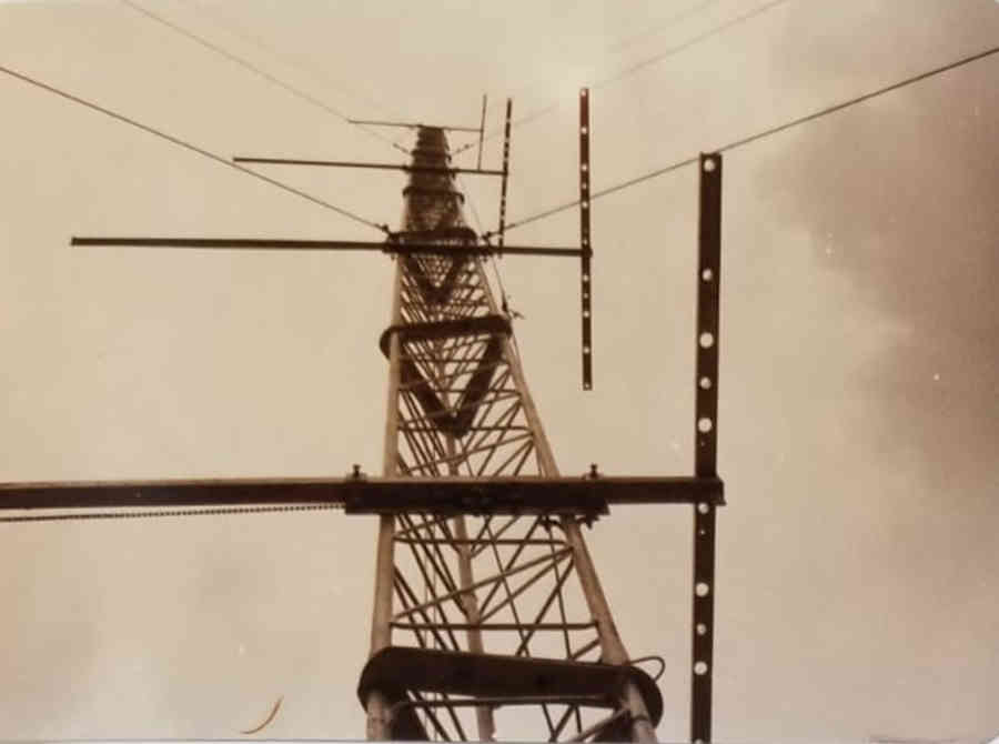
For about four months from May to September 1990, the Indian summer monsoon was the subject of unprecedented nationwide attention. While the monsoon winds raced from Kerala to the northwest of India in 35 days, less than its usual 45, researchers on land, air and sea belonging to over 20 institutions across the country were busy gathering data. Sensors on four towers – at Jodhpur, Delhi, Varanasi and Kharagpur – recorded data for 10 to 15 minutes every three hours, sometimes every hour during intensive observation periods, supplemented with data from sodars, balloons and tethersondes at these and other sites. The India Meteorological Department used its network of observing stations. The Indian Air Force did the same, and flew its AN-32 aircraft on sorties over land and over the Bay of Bengal, where ORV Sagar Kanya and its crew deployed their instruments. Meanwhile, INSAT clicked pictures from the sky.
This was the Monsoon Trough Boundary Layer Experiment (MONTBLEX). There had been monsoon experiments before, but all of them born of international initiative. “MONTBLEX was the first major national experiment in the country which India had decided to do,” says Roddam Narasimha, who conceived of the experiment along with the late DR Sikka of the Indian Institute of Tropical Meteorology (IITM), Pune. “It was our own.” Narasimha, professor at the Department of Aeronautical Engineering, was Chairman of the MONTBLEX Monitoring Committee.
He had been part of earlier monsoon field experiments too, leading the small group of researchers at IISc who went on to found, in 1982, the Centre for Atmospheric Sciences (now the Centre for Atmospheric and Oceanic Sciences, CAOS) at the Institute. One of these precursor experiments that set the stage for MONTBLEX was the Monsoon Boundary Layer Experiment (MOBLE), in 1979. MOBLE coincided with the Monsoon Experiment (MONEX), a large international effort to study the monsoon using some 20 ships and aircraft. MONEX resulted in a better understanding of rainfall on the west coast of India, including the effect of the Western Ghats.
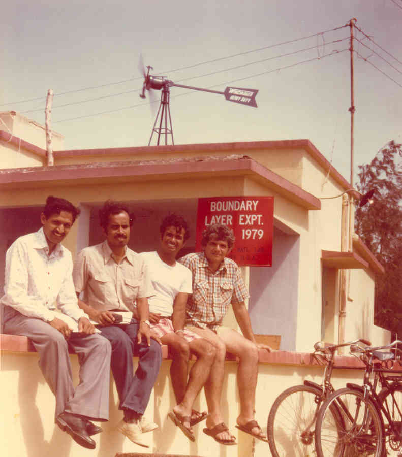
MOBLE was not officially a part of MONEX. “We were late entrants,” says Narasimha, “and didn’t have time to submit our proposal and get it accepted.” So he led a group of researchers from IISc and National Aeronautical Laboratories (now National Aerospace Laboratories, NAL) who went ahead on their own, supported by ISRO, and planned their experiment to overlap with MONEX’s intensive observation period. Their experiment marked the first time in India that an instrumented tower was used to study the role the boundary layer played in the dynamics of the monsoon.
The boundary layer of the atmosphere is the layer right next to the surface, whether land or ocean, with an average depth of 1 km but ranging from a few tens of metres up to 3 km. Because it’s the closest layer, it is strongly influenced by the surface through exchanging heat, moisture and momentum, and this exchange happens through turbulent processes. Such turbulent energy transfer in the boundary layer is an important process, especially for tropical weather systems such as monsoons and cyclones. For this reason, numerical weather prediction models need to incorporate it, on as small a scale as possible. However, such phenomena, called eddy transport, occur in short bursts, and studying them requires detailed measurements of velocity, temperature and humidity in the boundary layer. And this is the data the researchers from Bangalore aimed to gather.
“I was curious about what the atmospheric boundary layer was like in India,” says Narasimha. “It had not been studied at all – was it different in the tropics?”
For their experiment, Narasimha and his team – A Prabhu, BS Adiga, K Narahari Rao and Syed Ameenulla – had to first identify a site. “As one of the major objectives of the experiment was to make surface layer measurements during passage of a depression or cyclone (if possible),” they wrote in a report of their experiment, “it was necessary to choose a site where the probability of experiencing the event was as high as possible.” So they looked for a suitable site on the eastern coast, as the Bay of Bengal, one of the hottest sea surfaces, gives rise to many cyclones.
“I was curious about what the atmospheric boundary layer was like in India. It had not been studied at all”
They chose Chandipur beach, 20 km from the town of Balasore, Odisha, where they would have logistical and technical support from the Proof & Experimental Establishment of the Defence Research and Development Organization (DRDO). (Locally known as “Proof”, it has been a testing ground for guns and missiles since colonial times.) The beach is unusual in that the water line moves about 3 km between high tide and low tide, and this enabled the team to set up their tower in the sea, half a kilometre from the high tide water line.
But it wasn’t smooth sailing. They had to troubleshoot the instruments (at three levels on the 10-metre tower), the battery powering them, and the wires carrying the data back to the station on the shore. The wind vanes on the tower were attacked by birds of prey and some were lost initially. For acquiring data from the instruments, they were using a Z80 microprocessor, bought from one of its earliest dealers in Bangalore, who was helpful enough to even send two of his men along with a backup microprocessor. There were some teething problems, this being their first experience with digitised data acquisition. However, says Prabhu, “every time there were problems we would sit down, go through the programs, identify the problem and rectify the system.”
The team spent six weeks in Balasore. “Unfortunately,” said their resulting report, “the weather during July 1979 was rather unusual, and no depression or cyclone was generated in the head of the Bay during the period.” Nevertheless, they did gather valuable data. “That was a very tough, but an interesting and very enjoyable, experiment,” says Prabhu.
Just up the coast from Balasore was Digha, where a team of researchers from the US were based as part of MONEX. One of them was Sethu Raman (then at Brookhaven National Laboratory), with whom the IISc team did another tower experiment a few months later, this time in Raichur, during the total solar eclipse on 16 February 1980. Solar radiation is the dominant driving force of the atmospheric boundary layer. And during a total solar eclipse, as the report of the experiment said, “the radiation from the sun is first switched off, and then switched on again, in a matter of about two-and-a-half hours.”
The idea of the experiment was to study the boundary layer’s response to the eclipse, and what they found was interesting. “For example,” says Narasimha, “we found that small cumulus clouds disappeared as the eclipse moved towards totality, but reappeared as the eclipse receded – at about the same place where they were before, but they were now ragged, as if they had been torn apart.” Just as unexpectedly, even four hours after the eclipse ended, the wind speed was an order of magnitude lower than on other days, whereas just before the eclipse ended it was slightly higher than usual.
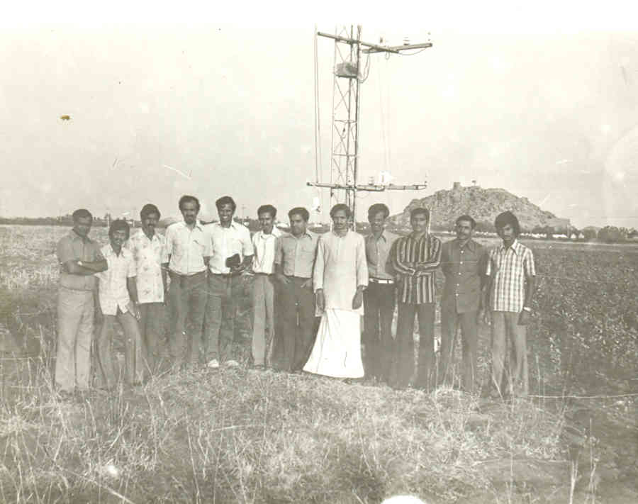
With the experience gained from these efforts, Narasimha and Sikka began planning for an experiment on a much larger scale. One problem with numerical models of the monsoon used for weather prediction was that the parameters for the atmospheric boundary layer they used were usually based on measurements done in mid- and high-latitudes elsewhere, rather than in the tropical region. To rectify this, they had to (as a later paper put it) fill the gap in the “knowledge about the boundary layer processes in the monsoon trough region” and “its linkage with the spatial and temporal variability of the large scale monsoon”.
“The monsoon trough is sort of a row of clouds, a line along which convective activity is strong,” says Narasimha. “That line moves from the south near the equator all the way up to the Himalaya, and takes 30 to 40 days.” Sikka and Sulochana Gadgil (a leading meteorologist and a former professor at CAOS), examining satellite pictures, proposed that another trough would then form in the south and travel northwards, and the cycle repeats. “This was the first new idea that came entirely from satellite pictures,” says Narasimha. “This movement was due to the monsoon trough. They said it’s at the heart of the dynamics of the monsoon.” The monsoon trough extends across the breadth of northern India.
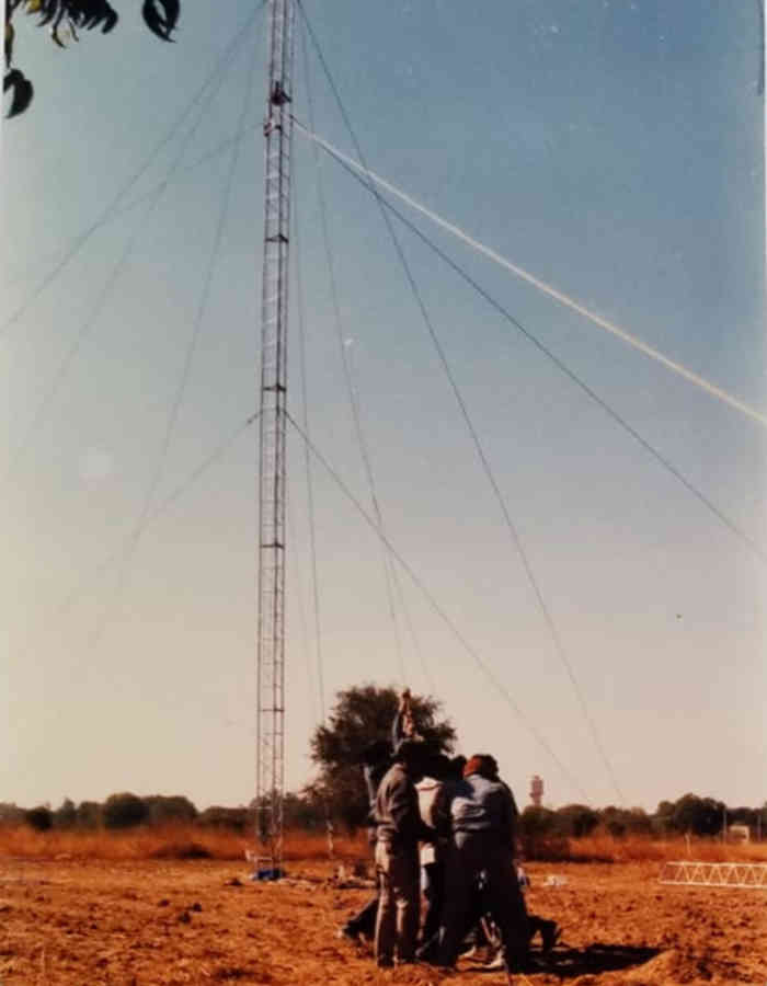
A pilot experiment was conducted in 1989, on farmland near IIT Kharagpur, with a 30-metre tower fitted with instruments to measure wind speed, humidity, temperature and direction of wind, at six levels. The aim was to measure the mean and fluctuating components of wind velocity, temperature and humidity. The hardware and software for the instruments and the PC-based data acquisition were all developed at IISc.
“The instruments withstood the vagaries of the tempestuous weather at the site in 1989,” said a paper reviewing the planning that went into MONTBLEX, “and the team had an opportunity to learn about possible problems when the data acquisition system failed due to lightning, power failure or theft of a section of the linking cable.”
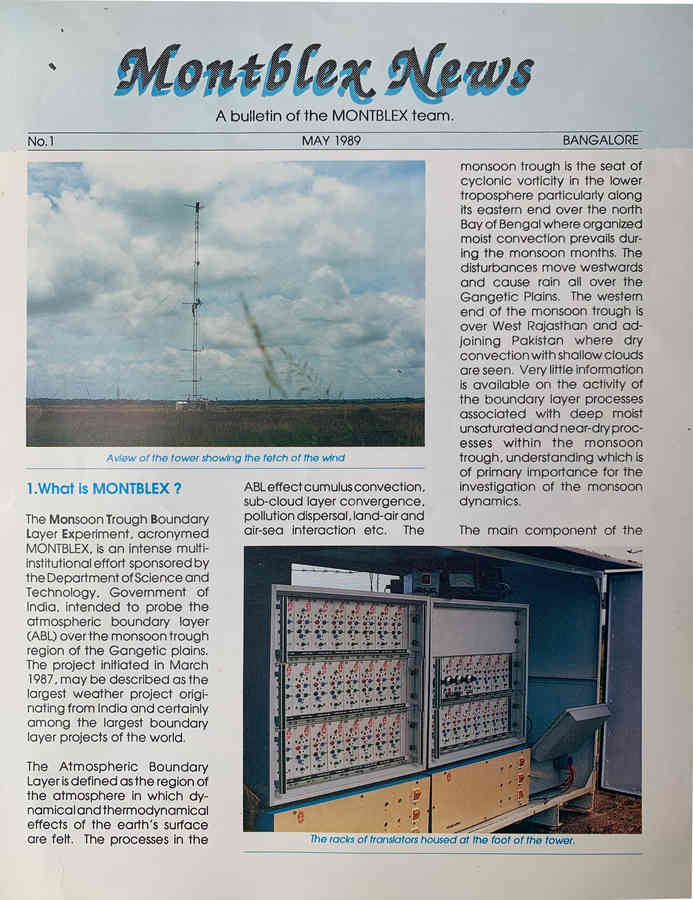
In preparation for the main experiment, training programmes were conducted at IIT Kharagpur, IITM and IISc. The main experiment in 1990 had 30-metre towers at the Central Arid Zone Research Institute in Jodhpur, IIT Delhi, BHU Varanasi, and IIT Kharagpur, all of them managed by Prabhu’s team at IISc, who also received the data from the towers. Things began badly in Jodhpur where floods, “the worst in a hundred years”, in late June disabled the tower for a few days, but it still gave the “cleanest and largest amount of data”. For attending to this and other issues with the towers, Ameenulla and Rudra Kumar (then a PhD student at IISc) travelled back and forth among the four sites.
“The time required to set right break-downs at any place,” wrote Prabhu and his team in a paper on MONTBLEX instrumentation, “depended chiefly on the current location of the expert team along the network of the tower stations!” Just as hard, remembers Prabhu, was putting in long hours through the four months to ensure the data kept coming. “Given that there was only one group to handle all these four systems, it was very very tough,” he says. “But I had an extremely dedicated set of people who worked hard to ensure that we got good data.”
The atmospheric boundary layer in the tropics don’t follow the relations that are defined in Western textbooks
That data was used by Narasimha and colleagues who found that the atmospheric boundary layer in the tropics had to be treated differently. “They don’t follow the relations that are defined in the Western textbooks, for the momentum flux, for the surface friction, how much heat transfer happens, and so on,” he recalls. This, he says, is because the process of convection is important in the tropics.
MONTBLEX, and subsequent monsoon field experiments, have had other enduring impacts too. “Each experiment enhanced the infrastructure facilities in the country, brought together scientists from different organizations to a common platform and also injected new people in this field,” as a review paper put it. “It was a unique effort in which the Indian research community on its own conceived the programme and implemented it successfully in all its phases.”
To read more articles in our series on the monsoon, click on the following links:
Sulochana Gadgil: A Lifetime of Monsoon Research
Interview with Syed Ameenulla: ‘Ours was a small group, like one family’
BoBBLE: ‘An Unusually Successful Cruise’
What an Adivasi Village in Chhattisgarh Can Teach Us about Sustainable Development
Decoding the Signatures of Monsoons Past in Fossils and Genes
Why Knowledge Isn’t the Barrier to Water Conservation
Chanchal Uberoi on Monsoon Melodies

